Meet/Start time : 07:00. At: Lisvane and Thornhill railway station car park , ST179835
Description: Cardiff to Abergavenny, via Rudry, Mynydd Machen, Twmbarlwm, Pontypool, Mynydd Garnclochdy and Blorenge, c6000 feet of ascent. Return by train.
Grid reference(s):Meet: ST 179 835, Start: ST 179 835, Finish: SO 305 136
Meet/Start time : 09:00. At: Byefield Lane (free) car park Tudor Street, Abergavenny., SO296141
Description: Self-supported jaunt. Participants must be self-reliant and be able to return themselves to Abergavenny should they need to drop out. Brisk pace. Walk to Hay On Wye via central Black Mountains, out to The Begwyns and return via western Blacks with climbing of 9900 feet.
Grid reference(s):Meet: SO 296 141, Start: SO 296 141
Meet/Start time : 09:00. At: Village hall car park Brockhampton., SO592320
Description: A combination of the Wye Valley Walk, Herefordshire Trail and 3 Choirs Way. Views of the River Wye, a beautiful thatch-roofed Church and fabulous woodlands.
Grid reference(s):Meet: SO 592 320, Start: SO 592 320
Meet/Start time : 08:30. At: Maryport Street north car park, SO376007
Description: 15 or 27 miles. A Figure of eight walk split between a tough first 15miles and a straightforward later 12 miles. Shop, cafe and toilets all available.
Grid reference(s):Meet: SO 376 007, Start: SO 376 007
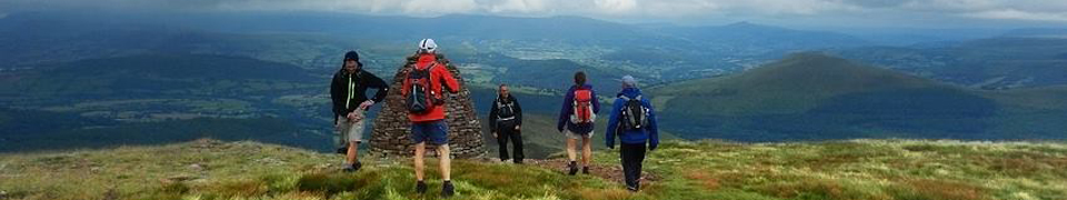
Meet/Start time : 00:00. At: Storey Arms, SN982203
Grid reference(s):Meet: SN 982 203, Start: SN 982 203
Map(s):Explorer: OL12
Leader: Bob Smith
More Bumming Around the Hills, Mega-Weeners, 35 miles, Saturday 9th August 2014,
Location, Photographs, Details
More Bumming Around the Hills, Mega-Weeners, 35 miles, Saturday 9th August 2014,
Location, Photographs
Meet/Start time : 09:00. At: Llangynidr free car park, SO155195
Description: 25.5 and then 9 miles. A figure of eight walk over the hills between the Black Mountains and the Central Beacons, from Llangynidr, climb Buckland Hill, Allt Esgair, Cockett Hill, Mynydd Troed, Pen Tir, Mynydd Llangorse, Cefn Moel (25.5 miles, 5100 feet). On second loop, ascend Tor-y-foel and the Wenallt (9 miles 2300 feet).
Notes: Unsupported, so bring enough food for the first leg and then, at cars, re-supply lunch boxes before second leg.
Grid reference(s):Meet: SO 155 195, Start: SO 155 195
The Forgotten Valley, 16 miles, Sunday 17th August 2014, Route: (view, download), Photographs
Meet/Start time : 09:00. At: Llangynidr car park , SO155195
Description: A walk up the forgotten valley of Cwm Clasifer. Carn Caws, Clo Cadno, Cwm Crawnon and ascend to Tor-y-foel, down to the Taff trail, then very steep track to the Wanallt, finishing with stroll along the River Usk.
Grid reference(s):Meet: SO 155 195, Start: SO 155 195
Deep in the Black Stuff, 38 miles, Saturday 30th August 2014, Route: (view, download), Photographs
Meet/Start time : 09:00. At: Rough Layby on Stanton Road., SO308217
Description: 19 or 38 miles. Figure of eight walk taking in the South and North Black Mountains, starting with Bryn Arw, Skirrid, Deri, Sugarloaf and Twyn y Gaer. Night section is Chwarel y Fan, Bal Mawr and Bal Bach.
Notes: Unsupported so bring enough food for the first leg (4700 feet) and then, at the cars, re-supply lunch boxes before second leg (4300 feet).
Grid reference(s):Meet: SO 308 217, Start: SO 308 217
Map(s):Explorer: OL13
Leader: Jason Winney
The Ultimate Ross Round, 26 miles, Saturday 6th September 2014, Route: (view, download), Details
The Ultimate Ross Round, 26 miles, Saturday 6th September 2014, Route: (view, download)
Meet/Start time : 08:30. At: Car park off Wilton Road, just over Wye Bridge in Ross., SO593238
Description: The full version, which takes in May Hill.
Grid reference(s):Meet: SO 593 238, Start: SO 593 238
Map(s):Explorer: OL14
Leader: Rob Wilkinson
Where Ravens Dare Marshals' Walk(2014), 26.5 miles, Saturday 13th September 2014, Route: (view, download), Photographs, Details
Where Ravens Dare Marshals' Walk(2014), 26.5 miles, Saturday 13th September 2014, Route: (view, download), Photographs
Meet/Start time : 08:00. At: Machen Village Hall car park, ST209890
Description: Walking the long route of the WRD challenge event.
Grid reference(s):Meet: ST 209 890, Start: ST 209 890
Meet/Start time : 09:00. At: Outside Bala Backpacking Hostel, 32 Tegid Street, Bala., SH925359
Description: A linear walk over the Arenig Hills. Taxis or a minibus will be used from Bala to the start point and then walk back to Bala. NO DOGS ON THIS WALK.
Notes: Please reserve your space with the walk leader when you commit to the weekend away. The taxis will be paid for from club funds and this service is available to South Wales members only. Total ascent 4300 feet. Some off piste walking!
Grid reference(s):Meet: SH 925 359, Start: SH 822 392, Finish: SH 925 359
Elenydd Back Pack, Day 1, 20 miles, Saturday 18th October 2014, Route: (view, download), Photographs
Meet/Start time : 10:00. At: Ystradffin., SN787471
Description: Walking to Soar y Mynydd passing by the wild Llyn Brianne, Doethie Valley and Pysgotwr Valley. There are some simple river crossings on this leg.
Grid reference(s):Meet: SN 787 471, Start: SN 787 471, Finish: SN 764 482
Elenydd Back Pack Day 2, 21 miles, Sunday 19th October 2014, Route: (view, download), Photographs
Meet/Start time : 08:00. At: Hafod Las (Top of the Pysgotwr Gorge), SN764482
Description: From our camp. Through Carn Nant yr Ast forest to locate the Cothie Valley, and make our way to Bwlch yr Rhiw where we ascend Mynydd Mallaen and pick-up the Cambrian Way back to Ystradffin.
Notes: Key to a good trip is not to carry too much.
Grid reference(s):Meet: SN 764 482, Start: SN 764 482, Finish: SN 787 471
Linear Night Walk, 15 miles, Saturday 13th December 2014, Route: (view, download), Photographs
Meet/Start time : 05:00. At: Skirrid car park , SO328164
Description: We drive to St Mary's Vale (6 miles) and walk back to the cars via the woods of St Mary's Vale to the Sugarloaf, 5 ways, Coed y Cerrig Woods, Bryn Arw and Skirrid.
Grid reference(s):Meet: SO 328 164, Start: SO 283 161, Finish: SO 328 164